
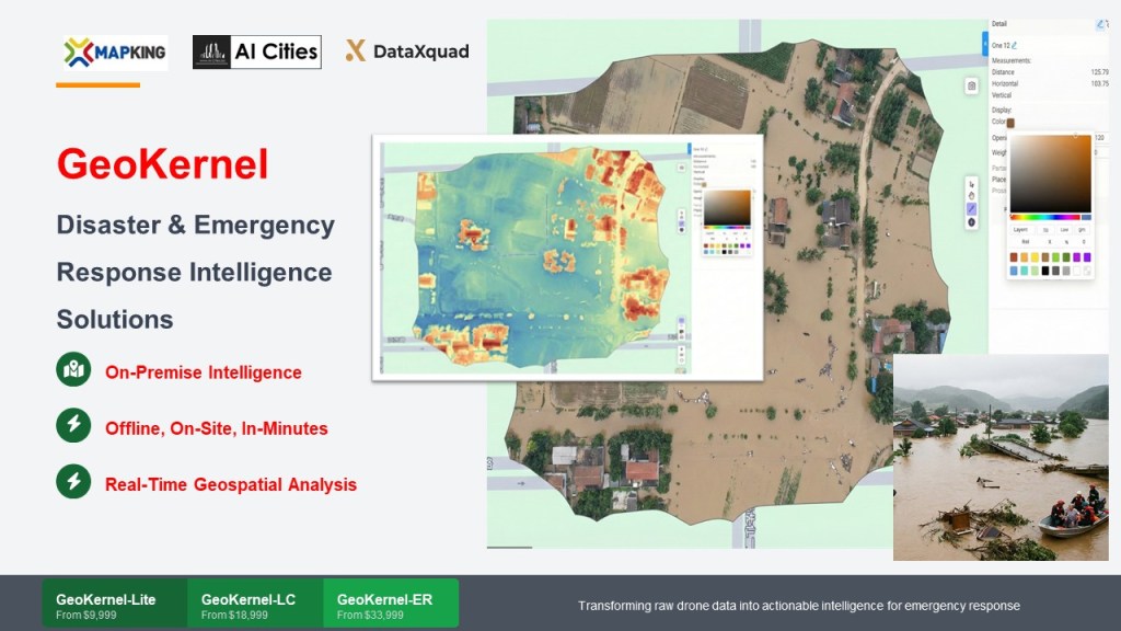
Geokernel is a rapid data capture and analysis software for Critical Emergency and Natural Disaster Response, an ideal software for the speedy processing of drone capture data on-site, thereby saving critical response time and enabling a rapid response in the field, often in remote areas.
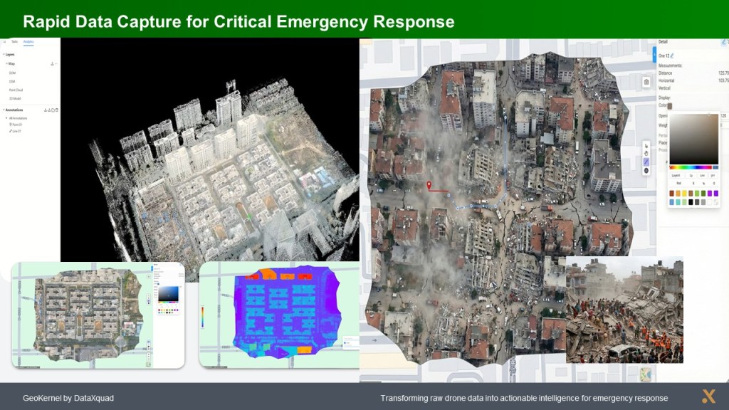
In traditional drone operation and disaster response service, the drone images are large and need to be unloaded after flying and send back to office for processing in order to 1) create 3D terrain (DSM) and identify objects. 2) to classify land uses, 3) to identify people and vehicles in the drone images. It takes several hours to several days to send large data disk to back office for processing and analysis. Geokernel solve this problem and helpful in providing Rapid Response.
With Geokernel, the processing on-site allows processing in remote areas, and the time required is from a few minutes to hour processing time (depends on size of data). The solution significantly reduced the response time, helpful in the critical missions in live evacuation and property saving.
Geokernel works with many major drone brands, and good to suit your existing drones.
Geokernel is a rapid data capture and analysis software for Critical Emergency and Natural Disaster Response.
Geokernel is an ideal software for the speedy processing of drone capture data on-site, generate 3D terrain, Digital Surface Model (DSM), enable rapid response in the field, often in remote areas.
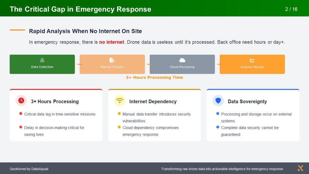
In remote site, capturing and delivering drone data needs 3+ hours minimal and back office analysis takes at least one day++. With Geokernel, it can be quickly done on-site where sending data is difficulty. Data sovereignty is also maintained.
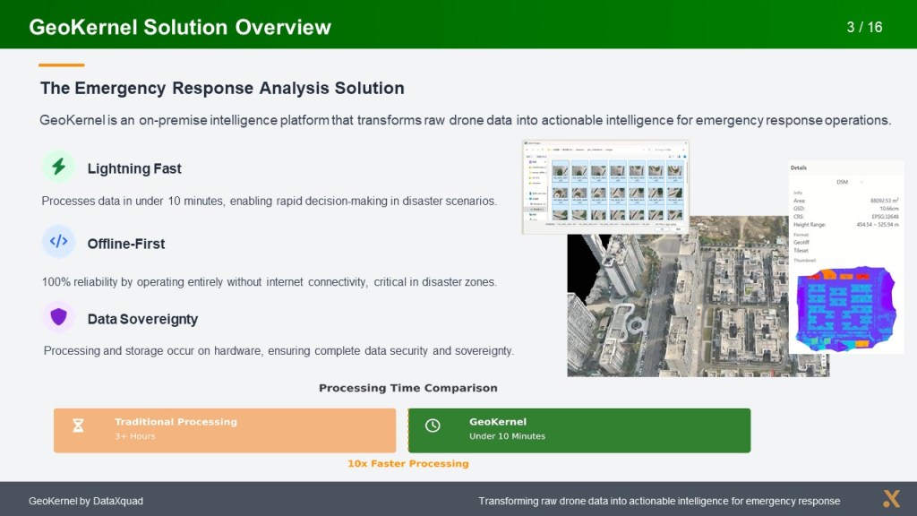
The processing power merge several drone images and create 2D and 3D map and models, Digital Surface Model (DSM) and 3D Contour map for analysis.
Geokernel – ER (emergency response)
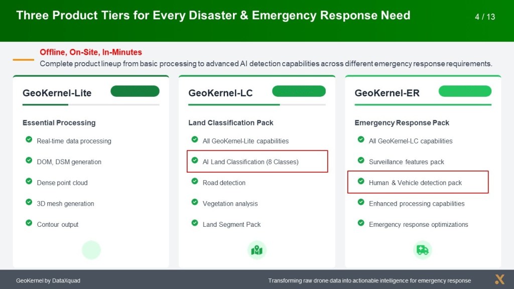
Geokernel – LC (land classification)
Geokernel – Lite
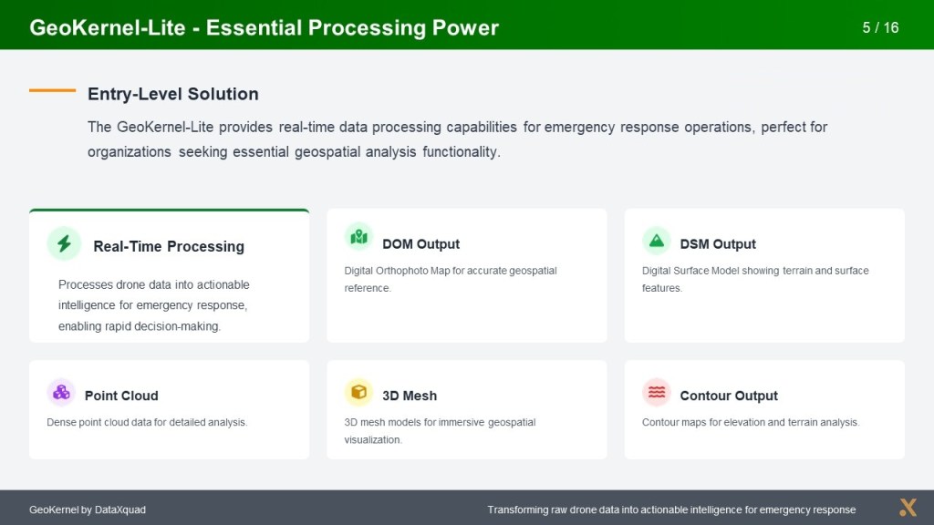
Entry Level – real time processing, DOM output, DSM output, Point Cloud, 3D Meah, Contour Output. Support most popular drones.
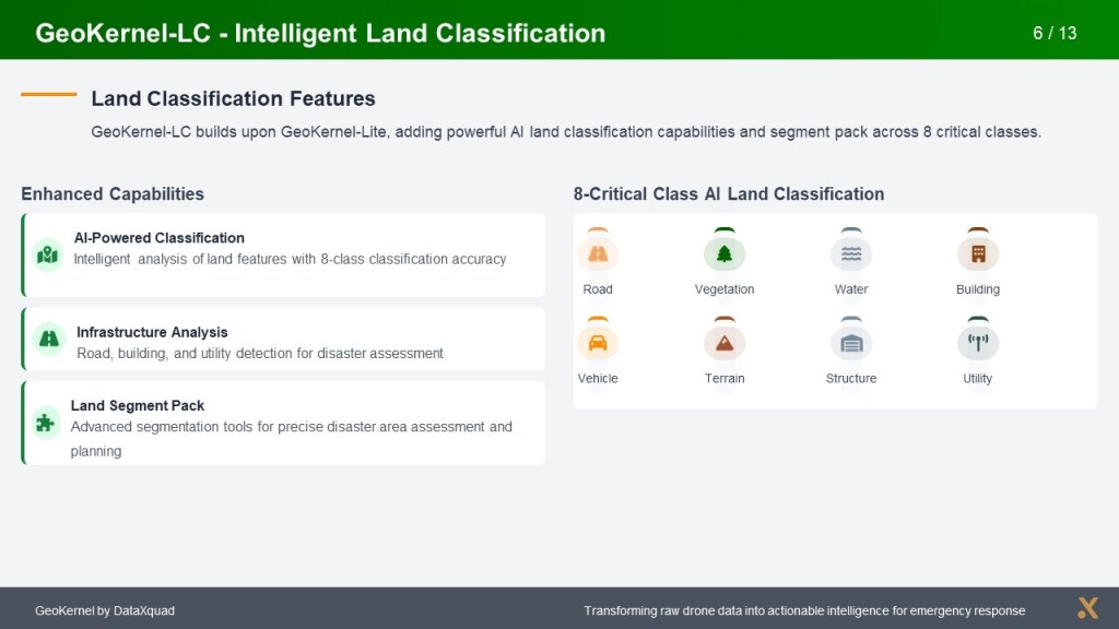
Land Classification (LC) – built-in AI to classify 8 critical land uses: road, vegetation, water, building, large vehicle, terrain, structure, utilities.
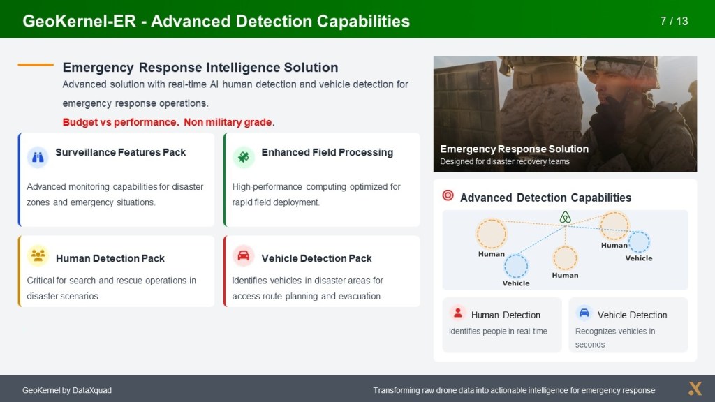
Emergency Response (ER) – built-in AI and Surveillance Features Pack in order to carry out critical missions to identify humans, detect vehicles, and enable rapid alarm and response. It is not military grade and budget.
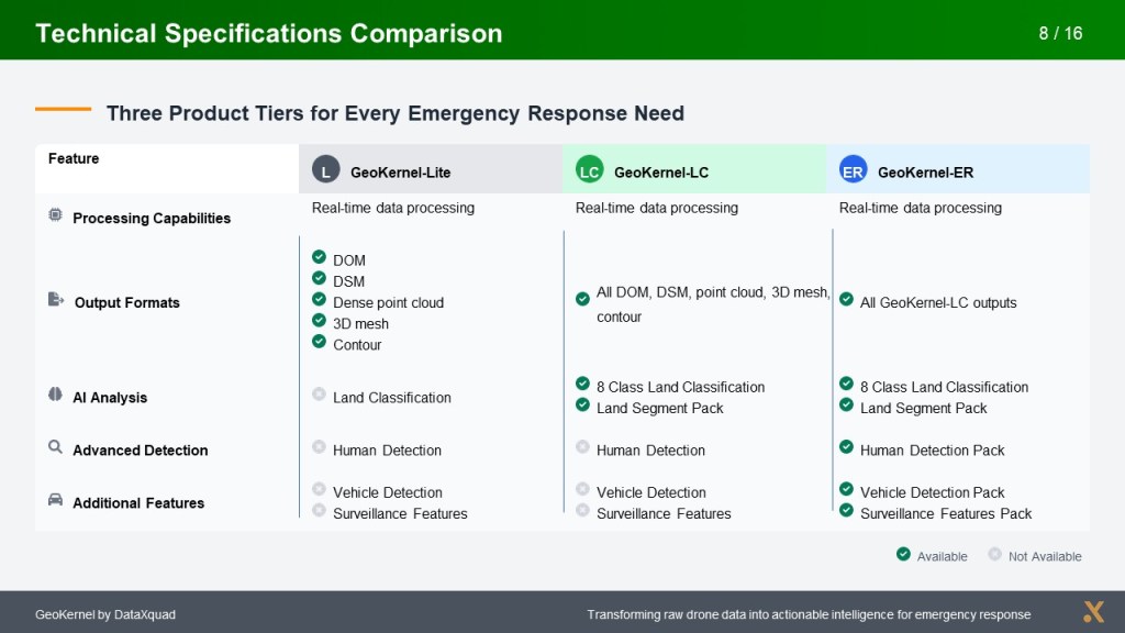
Upper level includes lower level functions.

Geokernel is built for Field Operations.
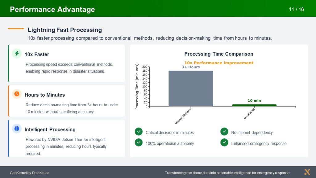
Analysis on the field with performance advantage.
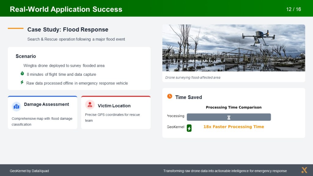
Bring a rugged notebook, go on field … built for Flood Response, Disaster Response…

Support most drone brands and partner with Aiu Technology.
